|
|
|
| |
Deconflicting Information
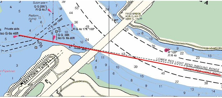
New charting information stems from a variety of sources. Sometimes, information from different sources conflict with each other or with existing charted features. For example, NOAA might receive coordinates for dredged channels from the U.S. Army Corps of Engineers. The Coast Guard might provide coordinates to NOAA for fixed range markers that should pass through the center of the dredged channel. If the Coast Guard or U.S. Army Corps of Engineers positioning information is slightly in error, the range line might not pass through the middle of the channel (as it does in the real world). Therefore, the conflicts in the data must be resolved.
Cartographers will research the background for each source in question. Sometimes, one type of survey positioning might be more reliable than the other. Therefore, deference is given to the more accurate source. The final chart must "make sense" to the mariner. Ultimately, cartographic discretion must be invoked in some cases in order to resolve source conflicts.
|
|


