|
|
|
| |
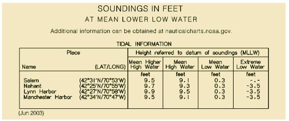
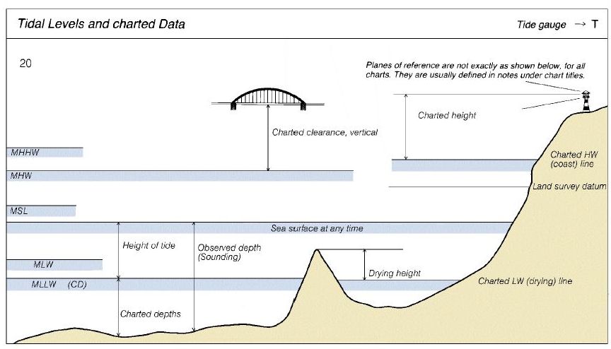
Sounding Datum
All depths indicated on nautical charts are reckoned from a selected level of the water called the sounding datum (sometimes referred to as the reference plane). For most NOAA charts of the U.S. in coastal areas, the sounding datum is Mean Lower Low Water. (MLLW). In the Great Lakes, the Plane of Reference is the International Great Lakes Datum (1985).
Depths shown on charts are the least depths to be expected under average conditions. Since the chart datum is generally a computed mean or average height at some state of the tide, the depth of water at any particular moment may be less than shown on the chart. For example, if the chart datum is MLLW, the depth of water at lower low water will be less than the charted depth as often as it is greater.
|
|


