
Other ITA web sites:
Ulreung volcano, South Korea
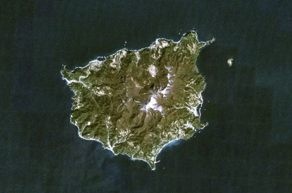
Ulreung volcano, also known as Ullung, forms a small 10-km-wide island in the Sea of Japan about 100 km east of the coast of the central Korean Peninsula.
The island, seen in this NASA Landsat image (with north to the top) is a tourist destination from the Korean mainland.
The 984-m-high stratovolcano is truncated by a caldera. Ulreung was the site of a major explosive eruption at the beginning of the Holocene that produced pyroclastic flows and deposited ash across the Sea of Japan in central Honshu.
Ulreung volcano, also known as Ullung, forms a small 10-km-wide island about 100 km east of the coast of the central Korean Peninsula.
The high point on Ulreung-do (Ulreung Island) is 984-m-high Seonginbong Peak.
The trachyandesitic Ulreung stratovolcano is truncated by the Nari caldera.
Ulreung was the site of a major phonolitic explosive eruption at the beginning of the Holocene from Nari caldera that produced pyroclastic flows and deposited ash across the Sea of Japan (East Sea) in central Honshu.
PHOTO SOURCE: NASA Landsat7 image (worldwind.arc.nasa.gov) courtesy of the Global Volcanism Program, Smithsonian National Museum of Natural History, used with permission.
NOTE: The information regarding Volcano on this page is re-published from other sources. No claims are made regarding the accuracy of Volcano information contained here. All suggestions for corrections of any errors about Volcano photos should be addressed to the copyright owner noted below the photo.