
Other ITA web sites:

Bulusan volcano, Philippines
Frequent eruptions, recorded since the mid-19th century, have kept the summit of Bulusan volcano unvegetated.
The principal summit crater is 300-m wide and 50-m deep.
Two craters are located on the lower SE flank, the lower of which contains a crater lake.

Luzon's southernmost volcano, Bulusan, was constructed along the rim of the 11-km-diameter dacitic-to-rhyolitic Irosin caldera, which was formed about 36,000 years ago.
Bulusan lies at the SE end of the Bicol volcanic arc occupying the peninsula of the same name that forms the elongated SE tip of Luzon.
A broad, flat moat is located below the topographically prominent SW rim of Irosin caldera; the NE rim is buried by the andesitic Bulusan complex.
Bulusan is flanked by several other large intracaldera lava domes and cones, including the prominent Mount Jormajan lava dome on the SW flank and Sharp Peak to the NE.
The summit of 1565-m-high Bulusan volcano is unvegetated and contains a 300-m-wide, 50-m-deep crater.
Three small craters are located on the SE flank. Many moderate explosive eruptions have been recorded at Bulusan since the mid-19th century.
Bulusan volcano, seen here from the west, is the southernmost volcano on the island of Luzon. Bulusan, along with other cones and domes, is constructed within the 11-km-wide Irosin caldera.
Frequent moderate explosive eruptions have been recorded since the mid-19th century from craters at the summit of the volcano.

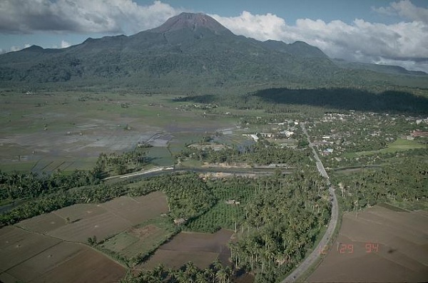
The south wall is the most prominent segment of the 11-km-wide Irosin caldera, and overlooks a broad, flat caldera floor below the active volcano of Bulusan.
The northern caldera rim has been buried by the slopes of Bulusan and other post-caldera cones.
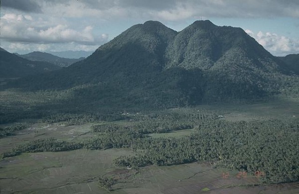
Mount Jormajan, a large lava dome on the east side of Bulusan volcano, was constructed at the western side of the 11-km-wide erosion caldera.
This view from the south shows the flat caldera floor in the foreground, with the western caldera wall visible at the extreme left.
Bulusan, seen here from the south, rises to 1565 m above the low-lying floor of Irosin caldera.
Bulusan is the youngest of several cones and lava domes constructed within the caldera.
The city of Irosin (right) is the largest of several towns within the caldera, which was formed more than 36,000 years ago.
Historical eruptions of Bulusan have been restricted to vents at the summit, although flank vents also are found low on the SE side.

This is a profile of Mount Bulusan, February 2007, with activity that appeared to be releasing gaseous material and ash.

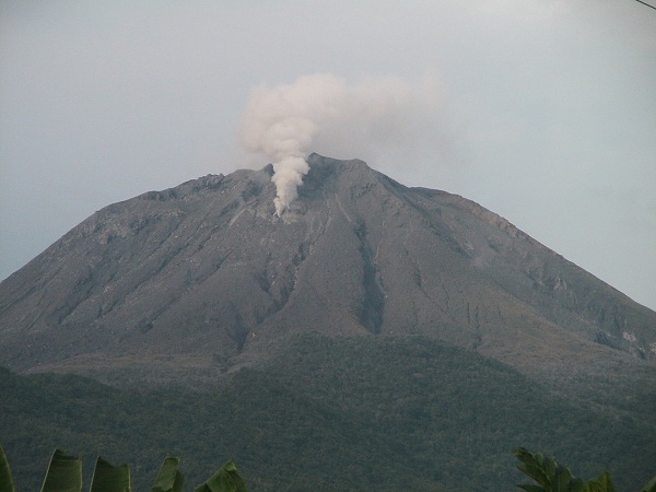

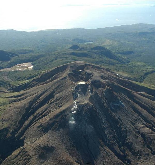


PHOTO SOURCES: Photos by Chris Newhall, 1984 (U.S. Geological Survey), courtesy of the Global Volcanism Program, Smithsonian National Museum of Natural History, used with permission, NASA, Wikimedia Commons.
NOTE: The information regarding Volcano on this page is re-published from other sources. No claims are made regarding the accuracy of Volcano information contained here. All suggestions for corrections of any errors about Volcano photos should be addressed to the copyright owner noted below the photo.